At a glance
- What it is
- A lower and an upper waterfall, fed by Mount Sneffels snowmelt, a few hundred feet from the Yankee Boy Basin road.
- The story
- The mountain above it is named for the volcano in Jules Verne's Journey to the Center of the Earth.
- Getting there
- About 7.5 miles from Ouray. The upper road is narrow with drop-offs, and four-wheel drive helps. Wildflowers usually peak mid-to-late July.
You know Journey to the Center of the Earth, the Jules Verne novel where the trip down starts inside an Icelandic volcano called Snaefell. The mountain above Twin Falls is named after that volcano. Its snowmelt is what pours over the falls every summer.
A mountain named after a volcano in a novel
Mount Sneffels is 14,153 feet tall, the highest point in Ouray County. In 1874 a Hayden Survey geologist, Frederick M. Endlich, named it after Verne's volcano. That same year Franklin Rhoda's survey team made it to the top and reported back.
The peak is so sharp that there is no room for more than two or three persons to stand on the very top.Franklin Rhoda, Hayden Survey, after the September 10, 1874 climb (as quoted by the Ouray News, 2026)
As of 2023 the peak is on Colorado driver licenses and ID cards. If you live here, the mountain that feeds Twin Falls might be in your wallet right now.
Snow on the mountain melts into Sneffels Creek, which drains Yankee Boy Basin. Partway down, the creek drops over dark rock in two strands. That's Twin Falls. OpenStreetMap, the free community-built map, marks a lower fall and an upper fall a short distance apart.
What nobody wrote down about Twin Falls
Here's the honest part. I went looking for the story of the falls themselves and came up nearly empty. No reliable source gives their height. No big event is recorded there. Even the reason for the name isn't settled in anything I could trust.
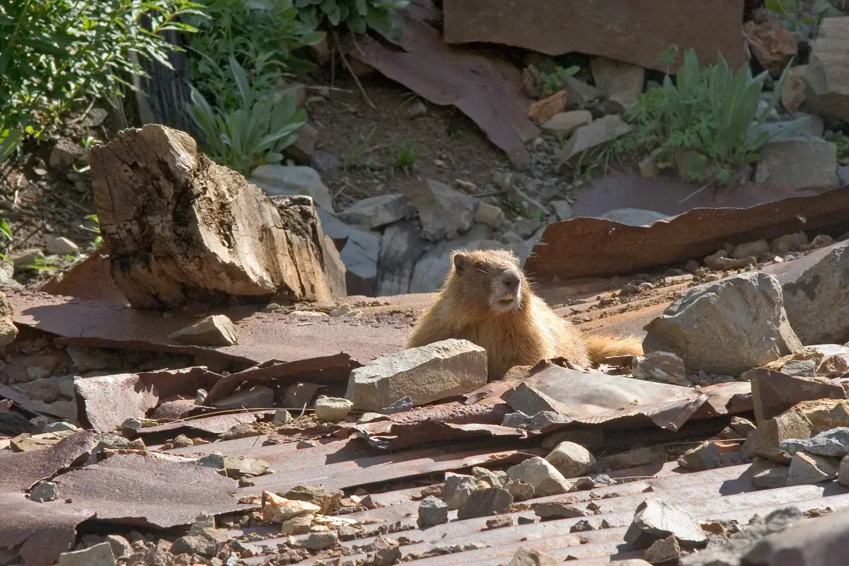
What the falls do have is marmots. A 2006 photo on Wikimedia Commons shows a family of them living in a collapsed mine building at the bottom of the falls, peeking out of the rusted sheet metal. Anyone whose cat has claimed a cardboard box knows the energy. The miners built it. The marmots moved in and never paid rent.
Miners dug the basin, and the creek kept running
The history is all around the falls, just not at them. Otto Mears finished the Camp Bird toll road in 1883 to reach mines in Imogene, Governor and Yankee Boy basins. Yankee Boy ore fed local mills, including the Atlas, the Torpedo Eclipse and the Tommy Boy. You can still see Atlas Mill remains and pieces of the Ruby Trust Mine along the road.
In the next basin system over, Albert E. Reynolds and John H. Maugham bought the Virginius Mine in 1880, at 12,300 feet, and more than 100 men lived in its four-story boarding house. That's not Twin Falls either. It's just the kind of neighbors the creek had.
Down the creek, the town of Sneffels was founded in 1875. The Revenue Tunnel there produced over $27 million in ore. Then in 1915 a fire destroyed the Revenue mill and many buildings around it, and the district never got back to its old size. The Sneffels post office closed in 1930 or 1935, depending on the source.
Through all of it, Sneffels Creek kept running downhill. Mining companies showed up with toll roads and mills, and the creek just kept going, like the Road Runner while one more coyote opens one more Acme box. The miners are gone. The water is still here.
Visiting Twin Falls today
From Ouray, take the Camp Bird Road (County Road 361) about 4.7 miles, then turn right onto the Yankee Boy Basin road. After about 2.8 more miles there are small parking areas on the left, and the falls are a few hundred feet from the road. The upper road is narrow in spots, with big drop-offs and no guardrails. Go in mid-to-late July if you can, when the wildflowers are out and columbines are everywhere.
Four-wheel drive helps in the roughest spots, and above treeline you may want low range. The Camp Bird Road is closed from December 1 to April 30, and late snow in June or early snow in October are both possible. Mining claims along the road are still held by companies, and some parcels are private. Explore the old mine remains at your own risk.