At a glance
- What it is
- A 12,152-foot peak next to Chimney Rock, and taller than its famous neighbor.
- The story
- Its east face rises nearly 2,000 feet in about half a mile. Unlike Chimney Rock, it has a hiking trail toward the top.
- Getting there
- Over Owl Creek Pass (regular cars), then FSR 860 to the Trail #144 trailhead. Wilderness rules: no bikes or motors. No water or restrooms.
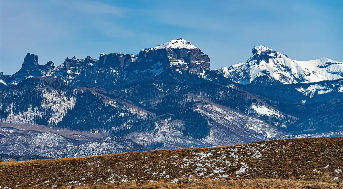
Courthouse Mountain is the taller one. At 12,152 feet it stands over Chimney Rock next door, and Chimney Rock still got the Hollywood close-ups and the climbing fame. Here's the twist: Courthouse is the one you can actually hike to the top of.
Sitting next to the class celebrity
Every school has the kid who sits next to the famous one. Courthouse Mountain is that kid. Chimney Rock, right beside it on the line between Hinsdale and Ouray counties, was called "the most difficult peak in Colorado" until two climbers took its summit in 1934. Then the Chimney Rock and Courthouse skyline showed up in How the West Was Won in 1962 and True Grit in 1969. Guess which one people point at.
That's a little unfair, because Courthouse Mountain is no slouch. Chimney Rock tops out at 11,781 feet. Courthouse beats it by 371. Its east face rises nearly 2,000 feet above the West Fork of the Cimarron River in about half a mile. Chimney Rock's east side does 1,600 feet in the same distance. On the report card, the quiet kid has the better grade.
A name nobody explains
The name Courthouse Mountain was already in use when Henry Gannett published it in the Gazetteer of Colorado in 1906. Why Courthouse? I don't know. I looked. None of the sources I read explain it, and I'm not going to invent a story about it looking like a county building just because that would make a nice sentence.
The road below has a little history of its own. The Montrose visitor guide says the Owl Creek Pass road follows an 1885 cattle-drive trail. Long before the movie crews, the big traffic through this valley was cows.
Courthouse Mountain goes wild in 1980
In 1980 Congress made the land around Courthouse Mountain part of the National Wilderness Preservation System. It started out as the Big Blue Wilderness. Today it's the 102,721-acre Uncompahgre Wilderness. From then on, the only ways up were your own feet or a horse. The rule list is thorough. Motorized equipment and mechanical transport are generally prohibited, and that covers bicycles, carts and even aircraft landings. If you were planning to helicopter in for the view, that's a no.
There's one odd leftover. The wilderness still holds a private gold mining claim staked in 1938, more than 50 years before the area became wilderness. Its name is the Robin Redbreast, which sounds less like a gold mine and more like the family parakeet. Its owners planned to haul ore out with mule teams.
Visiting Courthouse Mountain today
Here's where the quiet kid wins. Chimney Rock needs a technical rock climb. Courthouse Mountain is a hike. Forest Service Trail #144 branches off Courthouse Trail #218 and climbs from the wilderness boundary to a rocky ridge near the summit, with views to Silver Jack Reservoir and Uncompahgre Peak country.
To get there, take Owl Creek Pass Road (Ouray County Road 10) from US 550 about 1.7 miles north of Ridgway. Drive about 15 miles over Owl Creek Pass, turn right on FSR 860, and go about 1.6 miles. The trailhead is on the right and parking is on the left. The Montrose visitor guide calls the road maintained gravel that's fine for conventional cars. There are no restrooms or drinking water at the trailhead, so pack for it.
Go in July or later. Snow-free conditions in this wilderness usually run mid-July to early September. The famous neighbor gets the photos. You get the summit ridge. I'll take that trade.